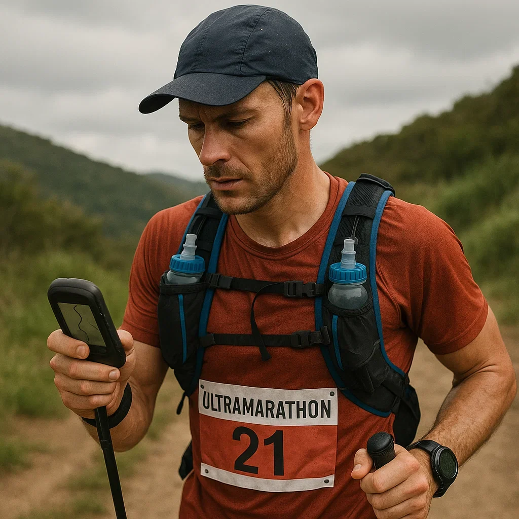
Ultramarathon runners face unique challenges when it comes to navigation. Running through vast trails, mountains, and remote locations means getting lost is a constant risk. That’s where GPX files come in.
What Are GPX Files?
GPX (GPS Exchange Format) files are simple, text-based files that contain geographical data. They are widely used in outdoor sports like ultrarunning, hiking, and cycling to help athletes stay on course. A GPX file can include:
- Waypoints: Specific points of interest (POIs) like aid stations, water sources, or dangerous sections.
- Tracks: A series of connected points that form a route or trail.
- Routes: A collection of waypoints that form a planned path.
GPX files can be loaded onto GPS devices, smartwatches, or even smartphone apps, providing a reliable digital map for your race.
Why Are GPX Files Essential for Ultramarathon Navigation?
- Prevent Getting Lost: GPX files ensure you always know where you are on the course.
- Accurate Route Tracking: Follow the exact race route, avoiding wrong turns.
- Access Critical Points: Identify aid stations, checkpoints, and hazards easily.
- Peace of Mind: Knowing you have a reliable map reduces navigation stress.
Common GPX File Errors and How to Avoid Them
Even the best GPX files can sometimes fail. Here are the most common problems:
- Incorrect File Format: Make sure you are using a .gpx file, not another type like .kml or .fit.
- GPS Device Compatibility: Ensure your device supports GPX files.
- Corrupted Files: Always download from a trusted source and test your file before race day.
How to Test Your GPX File Before Race Day
- Load the GPX file onto your GPS device.
- Physically follow the route on a training run (if possible).
- Simulate the race environment by enabling navigation and tracking.
Real-World Example: How a Runner Was Saved by a GPX File
Imagine running a 100K ultramarathon through fog-covered mountains. Visibility is zero. Runners around you are unsure where to go. But your GPS watch is loaded with a GPX file, and it shows you the way. You stay on course, reach aid stations without a problem, and finish strong. That’s the power of a well-prepared GPX file.
Conclusion
GPX files are more than just digital maps; they are a lifeline for ultramarathon runners. Understanding how they work, testing them properly, and avoiding common mistakes can turn a chaotic race into a smooth journey.
Ready to dive deeper? In the next part, we’ll explore how to set up your GPS device for perfect race navigation. Stay tuned!
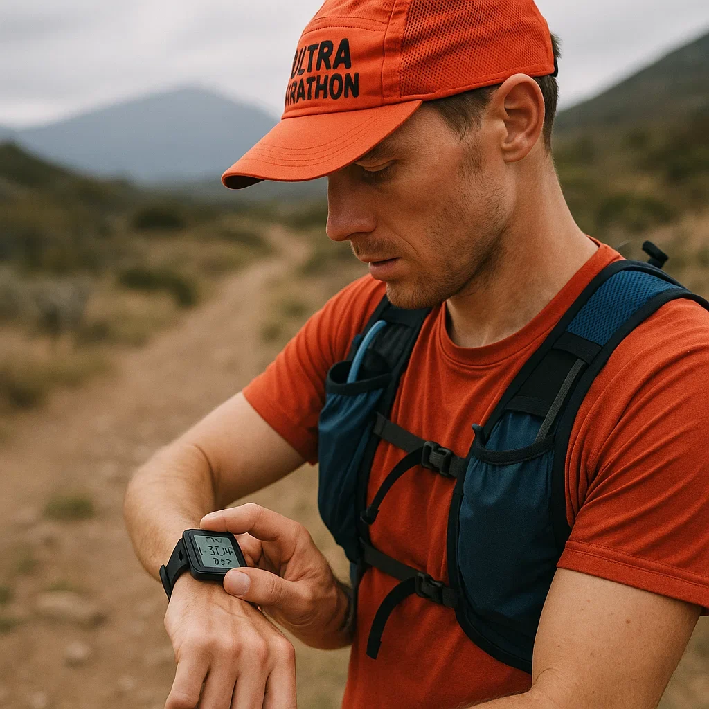
Setting Up Your GPX Device for Ultramarathon Navigation
Once you understand the basics of GPX files, the next crucial step is setting up your GPS device for race day. Whether you are using a GPS watch, a dedicated handheld GPS, or even a smartphone app, getting it right can make the difference between a smooth race and a disaster.
Choosing the Right GPS Device for Ultramarathons
- GPS Watches: Best for minimal weight and convenience. Popular models include Garmin Forerunner, Coros Vertix, and Suunto 9 Peak.
- Handheld GPS Devices: More robust with extended battery life. Ideal for multi-day races.
- Smartphone Apps: Apps like Gaia GPS and Strava are versatile but depend on battery life.
Uploading GPX Files to Your GPS Device
- Download the GPX File: Obtain the official race GPX file or create your own.
- Connect Your Device: Use a USB cable for handheld GPS or sync via Bluetooth for smartwatches.
- Upload the GPX File: Use your device’s app (Garmin Connect, Suunto App, Strava) to import the file.
- Test the Route: Ensure it loads correctly and displays the route properly.
Configuring Your GPS Device Settings
- Map Orientation: Set to “Track Up” or “North Up” based on preference.
- Distance Units: Ensure the device matches your race’s official units (miles or kilometers).
- Navigation Alerts: Enable turn-by-turn alerts if available.
- Backlight and Brightness: Optimize for battery life.
Battery Management for Long Races
- Activate Power-Saving Mode: Reduce screen brightness and disable non-essential sensors.
- Carry a Portable Charger: Essential for multi-day races.
- Use a Low-Power GPS Mode: Some devices offer a battery-saver GPS mode.
Troubleshooting GPS Errors
- Signal Loss: Move to an open area if possible.
- Freezing or Crashing: Restart the device.
- Wrong Route Loaded: Always test your GPX file before the race.
Real-World Example: Avoiding Disaster with a Properly Set Up GPS
Imagine running a mountain ultramarathon with dense fog. Your GPX route is loaded, but a friend’s device isn’t set up properly, and they miss a turn. You stay on track, finish strong, and help guide your friend back.
Conclusion
A properly set up GPS device is your best ally during an ultramarathon. From choosing the right model to optimizing battery life, these steps ensure you stay on course and avoid unnecessary stress.
Next, we will dive into creating and customizing your own GPX route for ultramarathons. Stay tuned!
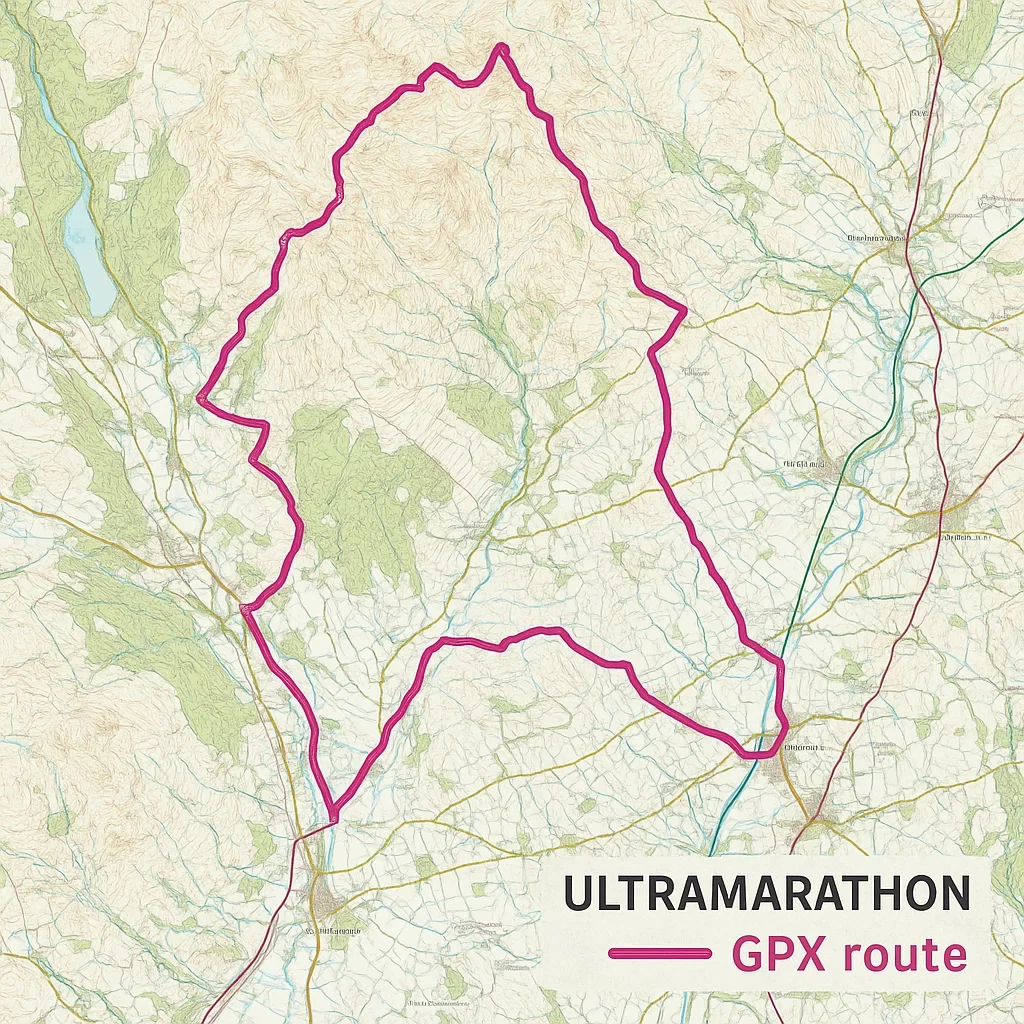
Creating and Customizing Your GPX Route for Ultramarathons
GPX files are only as good as the routes they contain. That’s why creating and customizing your own GPX route is essential for a successful ultramarathon. In this guide, we’ll show you how to design a reliable GPX route that keeps you on track.
Why Customize Your Own GPX Route?
- Control Over the Route: Ensure the route is accurate and aligns with your race goals.
- Add Critical Waypoints: Mark aid stations, water sources, and hazardous areas.
- Optimize Navigation: Tailor the route to avoid risky terrain or unclear paths.
Tools for Creating GPX Routes
- Strava Route Planner: User-friendly and ideal for quick route creation.
- CalTopo: Advanced mapping with elevation profiles and terrain analysis.
- Garmin Connect: Best for Garmin users, with direct device synchronization.
Step-by-Step Guide to Creating a Custom GPX Route
- Select Your Mapping Tool: Choose Strava, CalTopo, or Garmin Connect.
- Plot Your Route: Use the map to click and draw your desired trail.
- Add Key Points: Mark checkpoints, aid stations, and hazard areas.
- Adjust for Terrain: Check elevation profiles and ensure your route is runnable.
- Save and Export: Download the file as a .gpx file.
How to Customize Your GPX Route
- Add Multiple Routes: Create alternate paths in case of race changes.
- Highlight Dangerous Sections: Use waypoints with custom icons.
- Test Your Route: Load the GPX file onto your GPS device and review it.
Real-World Example: Optimizing a Race Route
Imagine you’re preparing for a 50K mountain race. The official route is marked, but it crosses a dangerous river. By creating your own GPX route, you find a safer crossing point without losing distance. On race day, your custom route keeps you safe while others struggle.
Conclusion
Creating and customizing your own GPX route is a game changer for ultramarathons. Whether you are avoiding hazards, adding aid stations, or optimizing the trail, this skill will make you a smarter, safer runner.
In the next part, we’ll cover advanced GPX navigation tips for ultramarathon success. Stay tuned!
Advanced GPX Navigation Tips for Ultramarathon Success
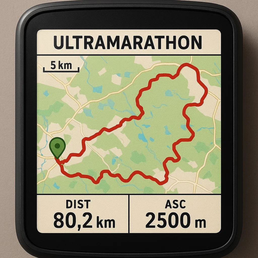
By now, you’ve learned how to create and customize GPX routes, but basic navigation isn’t always enough. In this section, we dive into advanced GPX navigation techniques to keep you on track, even in the toughest conditions.
Why Advanced GPX Navigation Matters
- Unpredictable Terrain: Dense forests, mountains, and deserts can all cause navigation challenges.
- Weather Impacts: Fog, rain, and snow can limit visibility, making GPS your best guide.
- Emergency Situations: In case of injury, a clear GPX route can help you or rescuers navigate back.
Advanced Techniques for GPX Navigation
- Using Multiple GPX Files: Load backup routes in case the main route is blocked or altered.
- Waypoint Management: Use color-coded waypoints for critical sections (e.g., red for hazards, green for checkpoints).
- Dynamic Route Adjustment: Know how to add or edit waypoints mid-race if conditions change.
- Trackback Feature: Learn to use your device’s “Trackback” or “Return to Start” function for emergencies.
Optimizing Your GPX Display Settings
- Contrast & Map Style: Use high-contrast colors for better visibility.
- Zoom Levels: Set your GPS device to automatically zoom in on critical sections (switchbacks, river crossings).
- Breadcrumb Trails: Enable breadcrumb mode for a clear route history.
Real-Time Problem Solving with GPX Navigation
Imagine you’re running a 100K mountain race, and dense fog rolls in. Visibility is gone. But your GPS shows the exact route with waypoints for each aid station. Other runners struggle, but you stay on course with confidence.
Common Advanced GPX Navigation Mistakes
- Overloading with Waypoints: Keep it simple. Only mark critical points.
- Ignoring Device Battery Life: Advanced navigation settings can drain your battery. Always manage power.
- Not Practicing with Your Device: Advanced settings are useless if you don’t know how to use them.
Pro Tips: Enhancing Your Navigation Skills
- Practice using your device’s advanced features before race day.
- Simulate bad conditions (fog, rain) during training with your GPS device.
- Save “panic waypoints” — quick-access waypoints for emergency exits.
Conclusion
Advanced GPX navigation can be a lifesaver in ultramarathons. By mastering these techniques, you ensure a safer, more efficient race experience.
In the final part, we’ll explore troubleshooting GPX navigation problems and staying on course no matter what. Stay tuned!
Troubleshooting GPX Navigation Problems in Ultramarathons
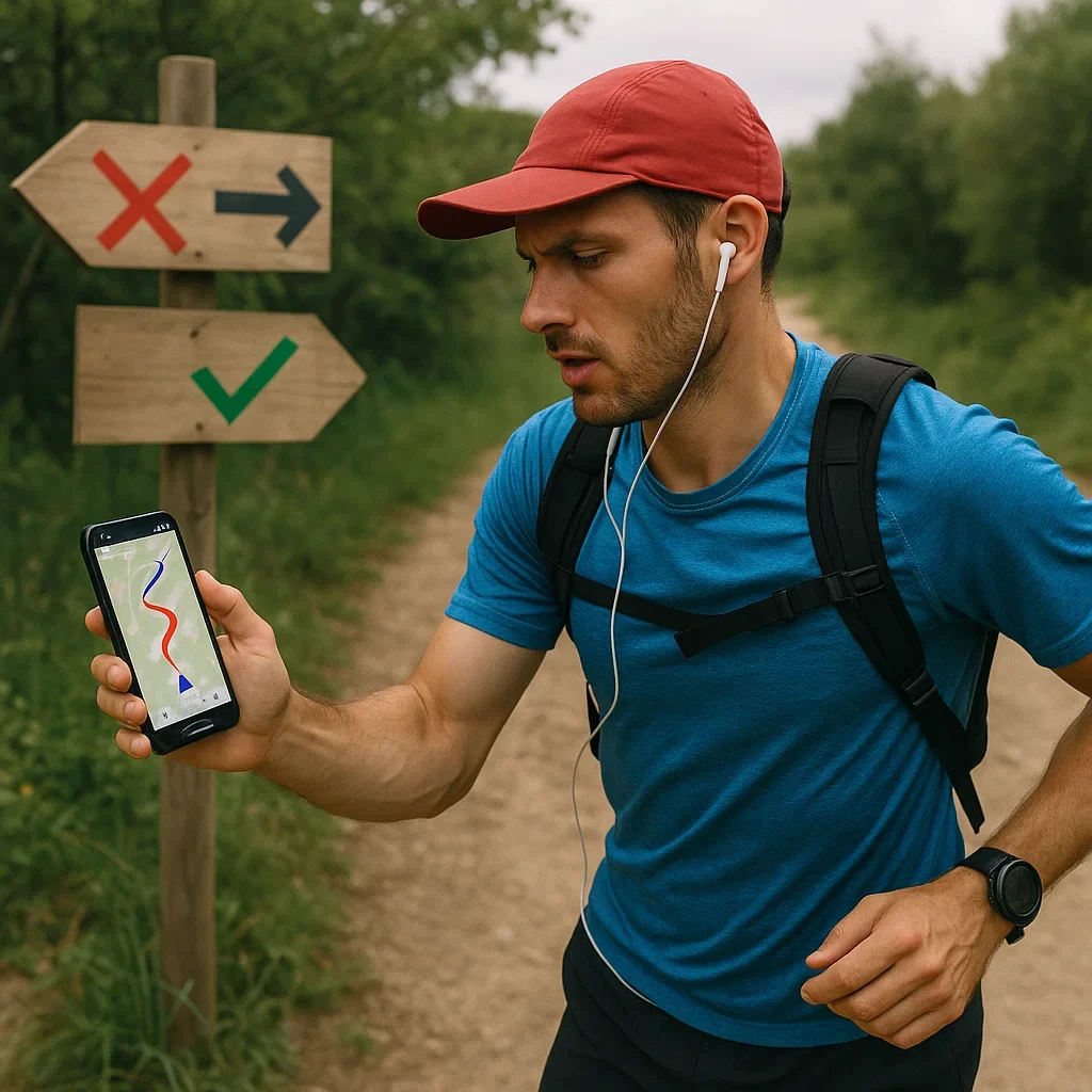
Even with the best preparation, GPX navigation problems can occur during ultramarathons. Whether it’s a corrupted file, signal loss, or a device malfunction, knowing how to troubleshoot can save your race.
Common GPX Navigation Problems
- Signal Loss: Your GPS device loses satellite connection in dense forests, canyons, or under heavy cloud cover.
- File Corruption: The GPX file fails to load or crashes your device.
- Battery Drains Quickly: Intensive GPS tracking can rapidly deplete your battery.
- Wrong Route Loaded: An incorrect GPX file is selected or the route is misaligned.
How to Troubleshoot GPX Navigation Issues
1. Fixing Signal Loss
- Move to an Open Area: If possible, get clear sky visibility.
- Enable High-Sensitivity GPS Mode: Use GLONASS or Galileo for better coverage.
- Switch to Map View: Manually follow the route using the map.
2. Repairing a Corrupted GPX File
- Download a Fresh Copy: Always have a backup GPX file on your phone or cloud.
- Test Files Before the Race: Load them on your device to ensure they work.
- Use File Repair Tools: GPX Editor or GPS Visualizer can help fix minor file errors.
3. Extending Battery Life
- Activate Power-Saving Mode: Reduce screen brightness and disable non-essential sensors.
- Carry a Portable Charger: Keep your device topped up during long races.
- Optimize GPS Mode: Use a lower frequency setting (like UltraTrac on Garmin).
4. Resolving Wrong Route Errors
- Double-Check the File Name: Ensure you are loading the correct GPX file.
- Review Your Route: Manually compare the map with the official course.
- Reload the Correct File: Remove incorrect files to avoid confusion.
Pro Tips: Avoiding GPX Navigation Problems
- Always Test Your GPX File Before the Race: Load it and walk through the route virtually.
- Save Backup Files: Keep an extra copy on your smartphone and cloud storage.
- Familiarize Yourself with Device Settings: Know how to quickly access GPS settings.
Real-World Example: Recovering from a GPX Navigation Failure
Imagine you’re halfway through a mountain race when your GPS device suddenly loses signal. Other runners are panicking, but you switch to your map view, identify the main trail, and guide others back on course.
Conclusion
GPX navigation is a powerful tool, but only if you know how to troubleshoot when problems arise. By preparing for common issues and knowing quick fixes, you can confidently navigate any ultramarathon.
This completes our series on GPX navigation for ultramarathons. Ready to turn these insights into a race-winning strategy? Let’s make it happen!
📚 Further Reading for GPX Navigation in Ultramarathons
To further enhance your knowledge and skills in GPX navigation for ultramarathons, explore these valuable resources.
🌐 Internal Articles (umit.net)
- Understanding GPX Files for Ultramarathon Navigation
- Setting Up Your GPX Device for Ultramarathon Navigation
- Creating and Customizing Your GPX Route for Ultramarathons
- Advanced GPX Navigation Tips for Ultramarathon Success
- Troubleshooting GPX Navigation Problems in Ultramarathons
🌐 External Resources
- Garmin Support – Using GPX Files on GPS Devices
- Strava Route Creation & GPX Export Guide
- CalTopo – Advanced Mapping and GPX Tools
- Gaia GPS – GPX Navigation App for Outdoor Adventures
- Official GPX File Standard Documentation (GPS Exchange Format)
📌 Pro Tip:
Bookmark this page for quick access to trusted GPX navigation resources anytime you’re planning an ultramarathon adventure.
Feel free to explore these links and master the art of GPX navigation for your next race!
📚 Further Reading
Master GPX navigation for ultramarathons with these expert resources. Internal links provide in-depth guides on umit.net, while external sources offer additional insights and tools.
🌐 External Resources
- 🌐 Garmin Support – Using GPX Files – Official guide to GPX file usage on Garmin devices.
- 🌐 Strava Route Creation & GPX Export Guide – Create and manage GPX routes on Strava.
- 🌐 CalTopo – Advanced Mapping and GPX Tools – Design and export complex GPX routes.
- 🌐 Gaia GPS – GPX Navigation App – Navigate and manage GPX files on your mobile device.
- 🌐 Official GPX File Standard Documentation – Learn about the GPX file format specifications.
❓ Frequently Asked Questions
📍 What is a GPX file, and why should I use it for ultramarathon navigation?
📌 A GPX (GPS Exchange Format) file is a digital map file containing route data that can be used with GPS devices to guide you along a predefined route, ensuring you stay on track during your ultramarathon.
📥 How do I upload a GPX file to my GPS device?
🔗 Most GPS devices allow you to upload a GPX file via USB, Bluetooth, or their companion apps (like Garmin Connect or Strava). Check your device’s user manual for specific instructions.
🛠️ Can I create my own GPX route for an ultramarathon?
🌐 Yes, you can create your own GPX route using tools like Strava, CalTopo, or Garmin Connect. These tools allow you to plot your route and export it as a GPX file.
🔋 How do I ensure my GPS device lasts the entire race?
⚡ Use battery-saving modes, reduce screen brightness, and carry a power bank if your race is particularly long.
🚫 What should I do if I lose GPS signal during the race?
🧭 Stay calm. Try moving to an open area with a clear view of the sky. If the signal doesn’t return, use offline maps or a backup GPX route if you have one.
🌐 Can I use my smartphone for GPX navigation?
📱 Yes, apps like Gaia GPS, Strava, or Komoot can turn your smartphone into a powerful GPX navigator. Make sure to bring a portable battery for longer races.
🔧 How can I make my GPX route more accurate?
🗺️ Manually adjust waypoints, avoid sharp angles, and use high-resolution map sources when creating the route.
🛑 What if I accidentally go off-route during the race?
📌 Stop immediately, re-check your GPX device, and use the “Trackback” feature if your device supports it. Calmly rejoin the correct route.
🎥 Recommended Videos
Explore these expert video guides to master GPX navigation and GPS management for ultramarathons.
📍 Understanding GPX Files
Learn what GPX files are and how they enhance ultramarathon navigation.
📱 Setting Up Your GPS Device
A step-by-step guide on configuring your GPS device for races.
🌐 Creating Custom GPX Routes
Discover how to create and customize GPX routes using online tools.
📚 Recommended Books
Dive deeper into ultramarathon training, GPX navigation, and outdoor adventure with these expert-recommended books.
🏃♂️ “Relentless Forward Progress” by Bryon Powell

A comprehensive guide to ultramarathon training and race preparation.
🌐 View on Amazon🗺️ “Ultramarathon Man” by Dean Karnazes

An inspiring memoir by one of the most famous ultramarathon runners.
🌐 View on Amazon🌲 “The Ultimate Hiker’s Gear Guide” by Andrew Skurka

A detailed guide on ultralight gear and navigation for long-distance adventures.
🌐 View on Amazon📝 Final Thoughts: Your Turn! 🚀
Thank you for exploring this guide! GPX navigation can be a game-changer for ultramarathon runners, and now you have the tools to master it. But don’t just take my word for it — try it on your next adventure. Map a route, sync your GPX file, and see how much more confident you feel on the trails. 🌲🏃♂️
💬 Did I miss something? Have a better GPX tip? Drop a comment below. I read them all. 😉
And if this guide helped you, please share it with your running friends! 📤

About the Author
Lost Pace is an ultramarathon runner, shoe-tester and the founder of umit.net. Based year-round in Türkiye’s rugged Kaçkar Mountains, he has logged 10,000 + km of technical trail running and completed multiple 50 K–100 K ultras.
Blending mountain grit with data, Lost analyses power (CP 300 W), HRV and nutrition to craft evidence-backed training plans. He has co-written 260 + long-form guides on footwear science, recovery and endurance nutrition, and is a regular beta-tester of AI-driven coaching tools.
When he isn’t chasing PRs or testing midsoles, you’ll find him sharing peer-reviewed research in plain English to help runners train smarter, stay healthier and finish stronger.
Ultrarunner · Data geek · Vegan athlete
